


Heavy rainfall likely in Odisha, two low pressure created
Heavy rainfall likely in Odisha, two low pressure created
 admin
admin
Bhubaneswar: Whilst Cyclone Gulab has caused heavy showering in majority of the coastal, south and south interior districtions of Odisha, precipitation will expected continuation over Bengal Bay for another two weeks at back to back low pressure.
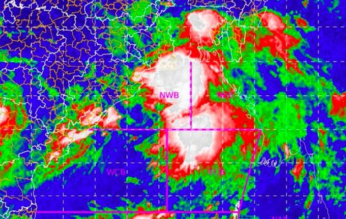
The Indian Department of Meteorology (IMD) reported on Tuesday that cyclonic circulation from Bengal off the coast of Myanmar on Monday is now located in the north east and the east and central bay of Bengal.
Under its influence, the North-West of Bengal off West Bengal and Bangladesh's surrounding coast would likely create a low-pressure system during the following 12 hours.
For two days starting September 29, significant rains will occur in most of the northern and northern inner districts. In addition, in many areas in the coastal regions during that period, there will be lightning thunderstorms.
On October 3, a cyclone flow will travel through the Philippines on October 5, the South China Sea on October 6, and the Myanma Coast on October 7, says senior meteorologist Dr Surendranath Pasupalak.
On October 8, it will go into the east-central Bay of Bengal and on October 9, it will become a low pressure zone. Three days until October 12, Odisha will get severe rains as a result.